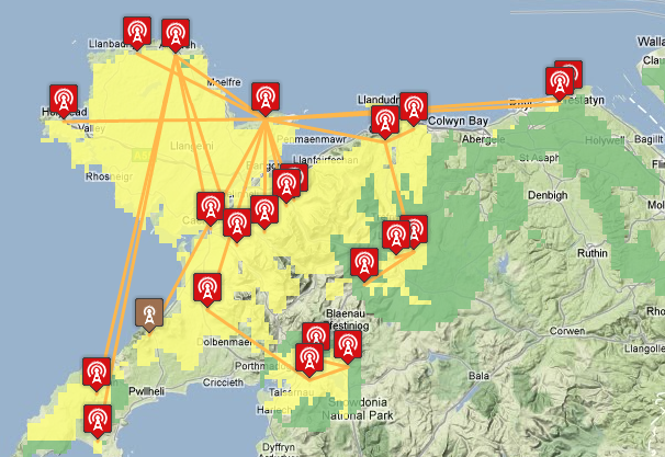
TV region maps now show network connections and transmitter types
 Brian Butterworth published on UK Free TV
 I have been considering this for a while, and I suspected it would be one of those "data entry on a rainy day" things to do - manually update the database so the UK Free TV mapping pages show the connections between the transmitters.
Using the information from the Transmitter Network - Digital UK Almanac I have updated the system to show the links between the transmitters, for example:

These are available for all switched-over regions, plus Oxford, minus (for some unspecified reason) the Carmel group in Wales and the Torosay and Selkirk groups in Scotland. Also missing is Stockland Hill in England.
If anyone has the Carmel, Torosay, Stockland Hill or Selkirk information, please let me know!
In addition, a separate symbol is now used to denote "Freeview Light" transmitters that only carry the public service multiplexes BBCA, D3+4 and BBCB, or will do after they have switched-over.
Your feed back is, as always, appreciated.
2:08 PM
The Channel Islands final installer newsletter isn't linked from the Almanac pages any more, but it is still at its original location: http://www.digitaluk.co.u….pdf
St Peter Port and Torteval are fed from Les Touillets, everything else is direct from Fremont Point.
| link to this comment |