
2050 Tube Map
Euston Kings Cross St Pancras station with Crossrail 1, 2 and High Speed 2. Photograph: Brian Butterworth

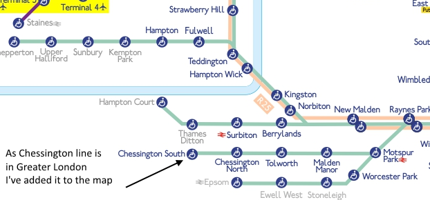
Download the WHOLE London 2050 - a Tube Map for the future as a PDF or click on this image to see it as an SVG (most modern web browsers support this).
![]()
Everything here is based 100% on the detailed reading of the London Infrastructure Plan 2050: Transport Supporting Paper (London Infrastructure Plan 2050 | Greater London Authority) and the amazing help I had from London Reconnections - Covering transport topics in and around London on their London 2050 (Part 1): The Trillion Pound Time Warp.
Things to look at
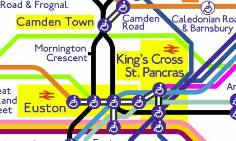
It was 100% essential to ensure that the Tube Map remained faithful to the one we use today, the one based on the designs of Harry Beck.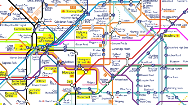
So, you will find that all the lines are horizontal, vertical or at 45 degrees.
All the station symbols (blue wheelchair, white wheelchair, coloured ticks and interchanges) are 100% standard.
One invocation that I did allow myself (spurred on by a comment from Diamond Geezer) was that the high-usage "destination" and "gateway" stations have larger font text and yellow highlight to help you locate these stations quickly.
Another slight innovation is that stations outside the "legal" Greater London area are shown with light colour text, and the M25 motorway is also shown where lines cross it.
As you can see from the above example, the following lines are shown that are not on the current map:
Crossrail 1: royal purple line. I am especially proud of the strong vertical in the top right hand side from Whitechapel to Stratford and on. This is going to be a fast line, so it has priority. On the right hand side the line is a strong horizontal and other stations have moved to accommodate the fast line.
Crossrail 2: line green line. This shows the current consultation route. I'm very proud of the way the line connects though the central area whilst remaining clear. This was quite a tough one to solve.
High speed 2: bright green line. Good use of direct lines for this express line.
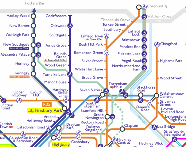
Overground: 2015 new lines in the Lea Valley, the above example showing the Chingford, Enfield Town and Chesunt lines (as well as Crossrail 2) with new interchanges.
The above diagram also shows the STAR line with Lea Bridge.
The Overground line from Upminster to Romford can also be seen on the whole map.
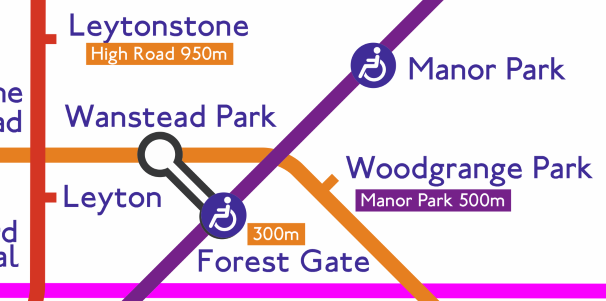
A useful little feature is out-of-station interchanges are shown with the walking distance.
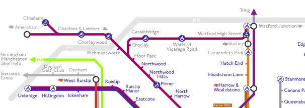
This section shows the use of "off page" markers to show connections outside the London area, such as HS2 to Birmingham, Manchester, Sheffield, Crossrail 1 to Tring. Also shown here is the new Watford arrangements for the Metropolitan line.
In the lower right section you can see the proposed additions to the Bakerloo line.
You can see from the detail that the map also shows the new Thameslink arrangments, as well as the proposed changes to the Overground to create an outer orbital route called on the map the "R25".
Anyway, I really hope you enjoy the hard work that has been put into this.
Brian
Extra! Extra!
The map featured on BBC London News on Wednesday!
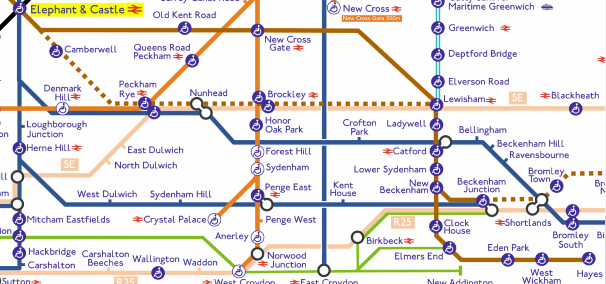
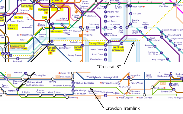
And now there is Crossrail 3 and Croydon Tramlink
Sunday, 7 September 2014
As this web site is all about TV reception,
the question is:
How good will the reception be in the underground in 2050?
| link to this comment |

Mark A: It's quite good today, given the Virgin broadband coverage. Which I get free with Three.
Free WiFi on London Underground - Support - Three
| link to this comment |

Monday, 8 September 2014
Fenchurch Street station's font seems smaller than comparable stations.
Seems like an arbitrary choice to include HS1 & HS2 and not other overground railway not run by TFL.
Obviously there's no zone information either.
Great map though - these are really only minor nitpicks :)
| link to this comment |
Great piece of work. A couple of comments:
I doubt HS1 and HS2 would ever actually be included in TfL "Tube Map" as they are long distance services and not incorporated in the shared fare system (or at least HS1 is not, we don't yet know for HS2).
Also since you included Thameslink (which was briefly on the map but is now off again), I think you ought to show that the new Blackfriers Station has access from both sides of the Thames - at least for mainline and Thameslink tracks if not for tube. Now there's as challenge as I think that is unique for London stations!
| link to this comment |
Awesome - but you seem to have left out Clock House on the Hayes line?
| link to this comment |
Stephen: Yes, Fenchuch Street doesn't have an TfL station, it's an NR station that can be walked to from Tower Hill (and Tower Gateway before it's removal). It's like that on the current map.
| link to this comment |
@Martin: The reason that HS1 and HS2 are on the map is that they are a bit part of the "London Infrastructure Plan 2050: Transport Supporting Paper" on which the map is based.
The convention on the map shows the river but doesn't show the bridges, so I'm not sure quite how you could show that about Blackfriar's. It's an interesting point though.
The Thamleslink lines are shown because they are getting a lot more services when the current upgrade is finsihed (did you spot the TL goes to Finsbury Park?)
| link to this comment |
@Stephen: I think that Clock House got lost in a CorelDraw! crash... I have put it in again. Thanks for the pointer.
| link to this comment |
@Philip
"Seems like an arbitrary choice to include HS1 & HS2 and not other overground railway not run by TFL. "
The map is to show the changes broght about by the "London Infrastructure Plan 2050: Transport Supporting Paper" so things are shown because they are in the plan.
"Obviously there's no zone information either. "
Perhaps there will be no zones in 2050? I didn't want to make the map look any more complicated than it needed to be, or get involved in Zone arguments about new stations such as Battersea Power Station Station.
"Great map though - these are really only minor nitpicks :)"
Thanks!
| link to this comment |
R
Richard E9:29 PM
Well done Brian , its very good & looks fantastic , I am a bit of a train buff myself .
| link to this comment |
Select more comments
Your comment please!