Local TV on Freeview - new Ofcom maps
 Brian Butterworth published on UK Free TV
 Here are the maps produced by Ofcom to show the local television on Freeview areas idenfitied in the Ofcom: Indicative locations for local television multiplexes - Initial technical assessment [pdf] document.
The maps are shown with the service covering most homes listed first, as on the
Local TV on Freview - table of winners and loosers page.
Crystal Palace, Sutton Coldfield and Brierley Hill
Emley Moor and Beecroft Hill (relay), Winter Hill (southeast petal) and Saddleworth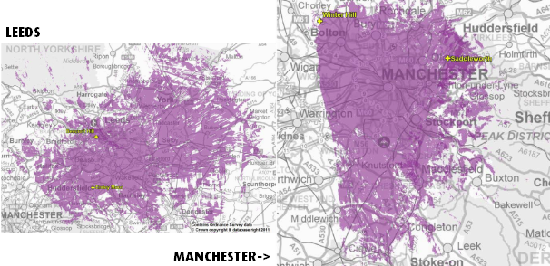
Fenham and Pontop Pike, Winter Hill (southwest petal) and Storeton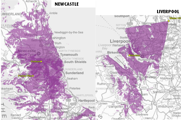
Black Hill (west petal), Craigkelly
Wenvoe, Black Hill (northeast petal)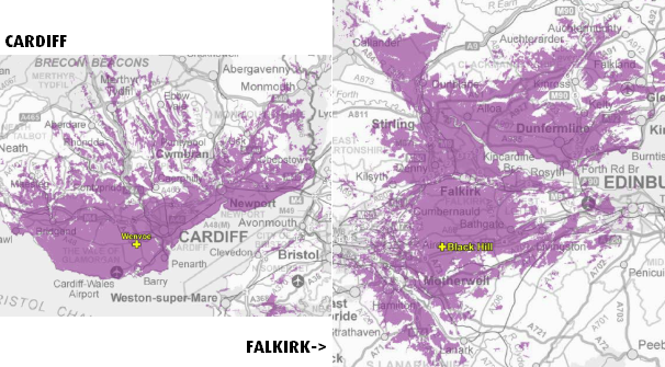
Rowridge, Angus and Tay Bridge (relay)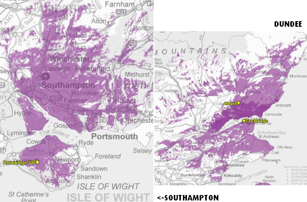
Bristol Kings Weston and Bristol Ilchester Crescent and Mendip, Hannington (northeast petal)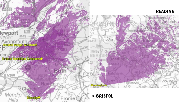
Winter Hill (northeast petal), Waltham and Nottingham
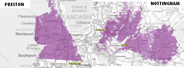
Bilsdale (north petal), Belmont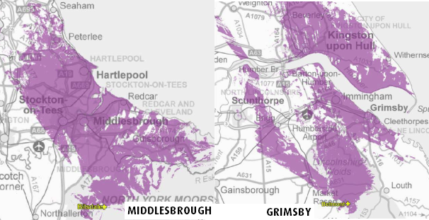
Divis, Bluebell Hill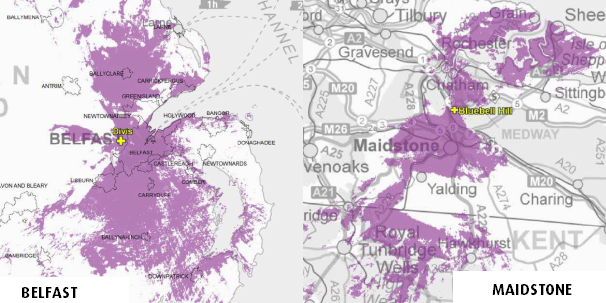
Sheffield, Guildford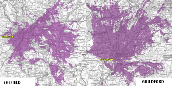
Darvel, Tacolneston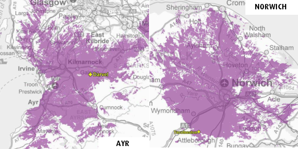
Whitehawk Hill, Fenton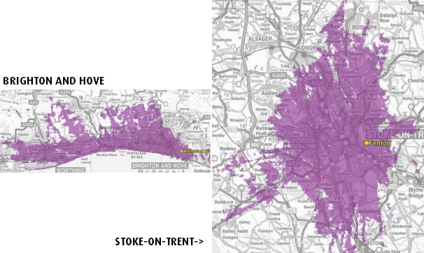
Bilsdale (south), Ridge Hill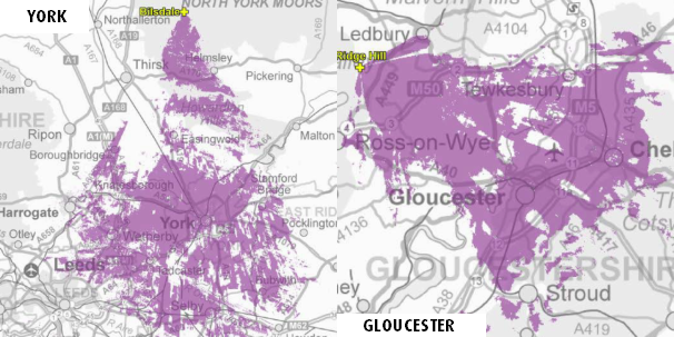
Lancaster, The Wrekin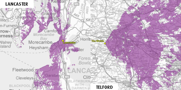
Durris, Pendle Forest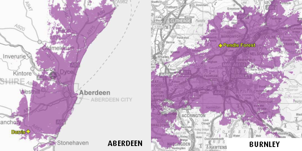
Caldbeck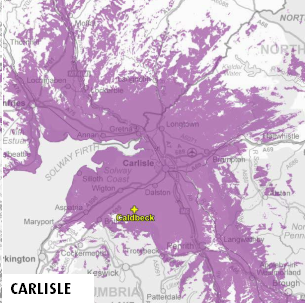
Reigate, Kilvey Hill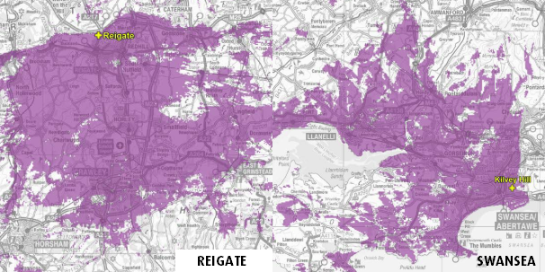
Hemel Hempstead, Oxford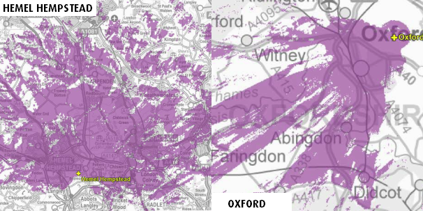
Heathfield, Plympton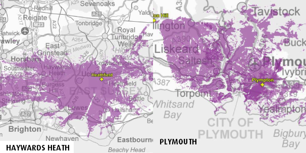
Moel-y-Parc, Hannington (southeast petal)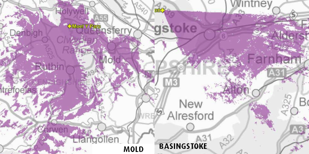
Madingley (Cambridge) (ex-C5), Bromsgrove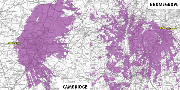
Luton, Keighley, Malvern, Rosemarkie, Lark Stoke, Sandy Heath, Tunbridge Wells, Limavady, Dover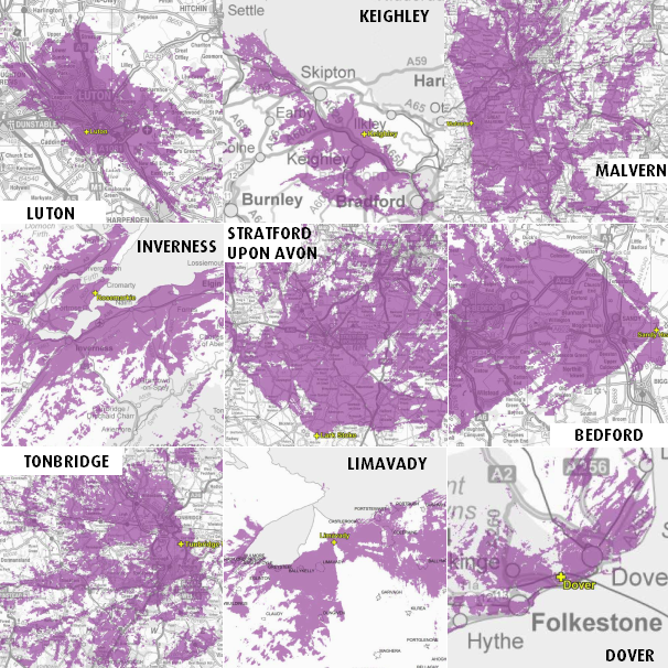
Carmel, Poole, Knockmore, Rosneath, The Wrekin (east), Ridge Hill (northeast), Olivers Mount, Salisbury, Londonderry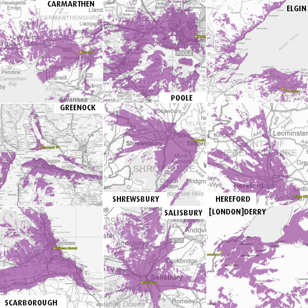
Kidderminster, Huntshaw Cross and Barnstaple (relay), Presely, Llanddona

7:53 PM
ITV ( Granada ) asset stripped the industry. I think they should replace the facilities they have destroyed. i.e 5 studios in Newcastle and a similar number in Leeds etc.
| link to this comment |
8:09 PM
Brian - But Chester is NOT in the Liverpool area - which, I now note, includes a "petal" of Winter Hill
Peter D - can you beleive a population of over 200,000 for Mold and surrounds, as shown?
Do you live in the lee of a big hill towards Meol-y-parc? Your local kebab shop gets good freeview
UK digital TV reception predictor
| link to this comment |
Peter D: To be fair, the studios in Newcastle were not destroyed, just allowed to decay. In addition, modern television is largely made outside of the studio, and such facilities are needed much less.
| link to this comment |
Steve P: The coverage areas are limited by the existing use of frequencies in a particular area.
| link to this comment |
9:45 PM
Brian:
You have the Mid-Sussex or Heathfield, Haywards Heath and Uckfield map displayed as Hemel Hempsted.
(The second map labelled Hemel Hempsted)
Some of the listed places are TV relays, some are radio transmitters and some don't have any type of transmitter.
Do you know if successful they will transmit from that town or just from the nearest main transmitter?
| link to this comment |
10:14 PM
Derby
Just wondering if it is clear yet what will be received in Derby, currently we receive Sutton Coldfield (West Mids) for the most part but can still receive Waltham (East Mids) if the weather is good. Will this change after switchover?
| link to this comment |
Ash's: mapA's Freeview map terrainA's terrain plot wavesA's frequency data A's Freeview Detailed Coverage
10:26 PM
Briantist: I have pictures of the bulldozers crushing Tyne Tees TV. It was stripped then destroyed. If that isn't destroyed, then I don't know what is!
| link to this comment |
MCMLXII: Sorry, an alliterative error. I have corrected it.
Yes, Ofcom note that the calculations are based on having the transmitter "half way up the mast".
As far as I have seen all the transmitters are current TV transmitters.
The transmissions will be from the masts as indicated above, I'm not sure what the point of doing all the work on the projections would be otherwise.
Sorry, if I have missed something.
| link to this comment |
Peter D: From what I remember on my visits to Tyne Tees the whole complex was falling down, it was an old theatre complex as I recall.
| link to this comment |